 GPS' are super cool. I've been carrying a Garmin eTrex for a while to put GPS coordinates into the photos I've taken. This is part of the WWMX Project from Microsoft Research. It's very slick.
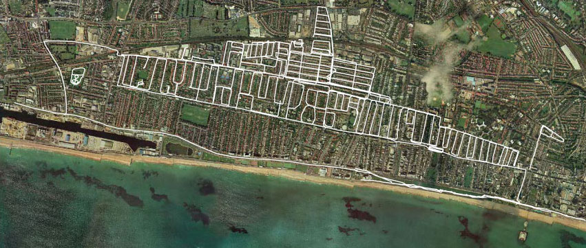
One of the cool side effects of always carrying a GPS is that I can see where I've been. It's been neat to see my paths charted out. Now, people with too much time and money have started drawing pictures by moving along the streets of their town with a GPS. The resulting tracks make words 70 miles high, etc. Kind of neat. Check out http://www.gpsdrawing.com.
I should note that this entry and the food simulator entry come from today's New York Times Magazine. This issue has a fun article on the "Ideas of 2003". Other "winners" were things like the "Nicotini", "PowerPoint Makes You Dumb" (a view I have expressed for years...), and more crazy Japanese inventions like "Spray-On Stockings."

Leave a comment